We may earn money or products from the companies mentioned in this post. As an Amazon Associate, I earn from qualifying purchases.
Earlier this summer, we took a two-week European vacation, travelling in Spain and along the French Riviera. We started in Sitges, Spain, and then spent time in Barcelona. After that, we flew to Nice to spend some time in the little town of Villefranche-sur-Mer. We stayed four nights in Villefranche-sur-Mer and absolutely loved it! One of our favorite experiences was walking the Cap Ferrat coastal path and enjoying the beaches along it.
The summer before, we did something very similar, again flying into Nice. On that trip, we spent a few days in Antibes, France, where we hiked the Cap d’Antibes. We really enjoyed that experience, which is what prompted us to find something similar this year!
In this France travel blog post, I want to share details about the Cap Ferrat hike and show some of the pictures I took of the beautiful trail, the beaches, and the coastline. It’s a great family activity, and there are snacks!
The Cap Ferrat Coastal Path Overview
The Cap Ferrat Coastal Path is located on the Cap Ferrat peninsula. On any map, this trail and others similar to it may be referred to as Sentier du Littoral, which literally translates to coastal path. These coastal paths are all over the French Riviera. And, I highly recommend you take time to walk this trail, especially if you are staying nearby in Villefranche-sur-Mer, Beaulieu-sur-Mer, or Saint-Jean-Cap-Ferrat!
For reference, the Cap Ferrat peninsula is just east of Nice. It covers about 200 hectares between Beaulieu-sur-Mer and Villefranche-sur-Mer. It’s part of the renowned French Riviera (Côte d’Azur) area, which includes the gorgeous French communities along the Mediterranean coastline.
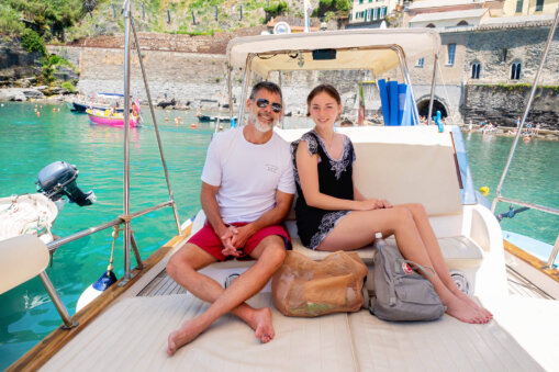
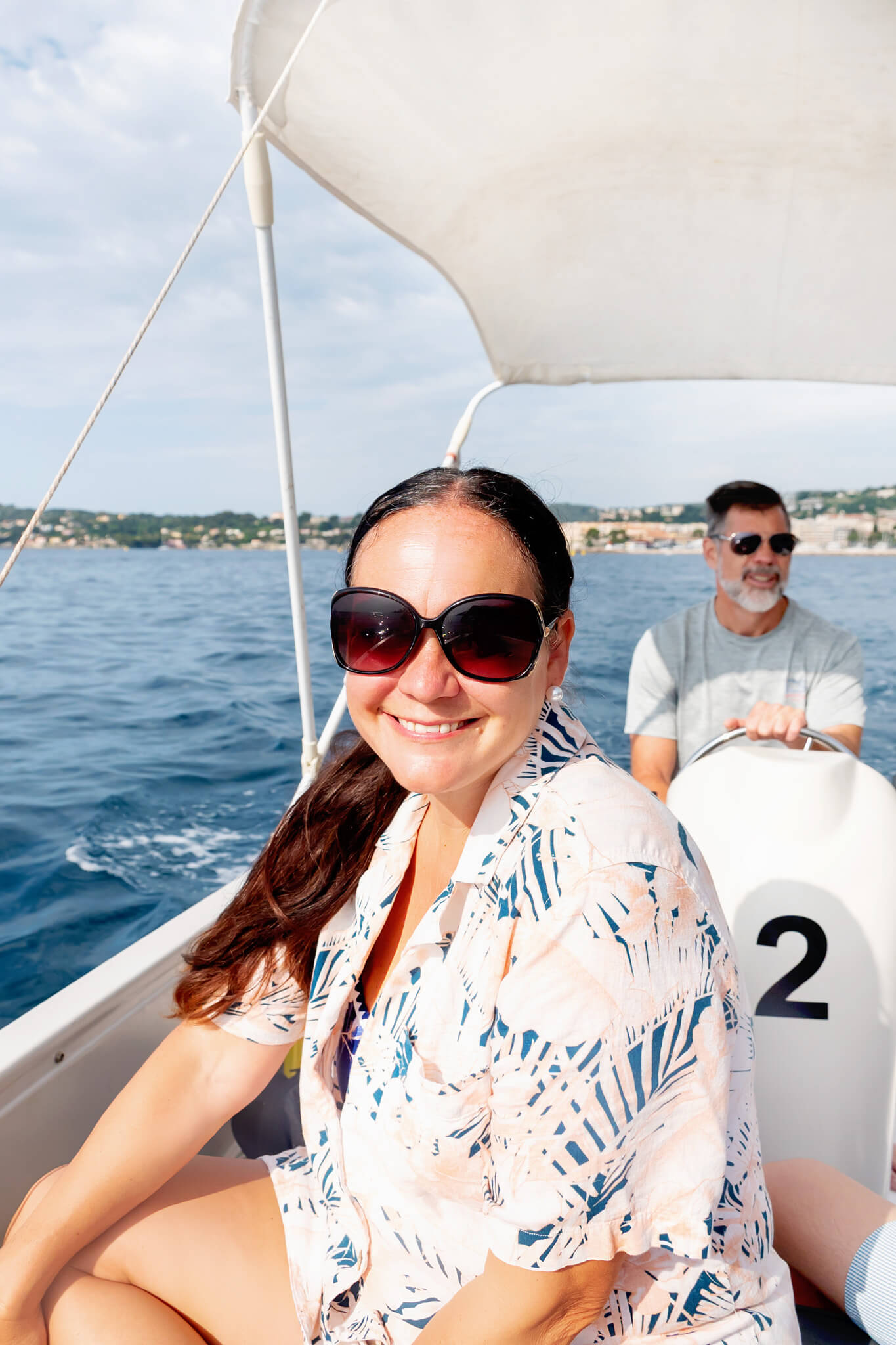
During our stay, we visited this area twice! Once, on the hike that I am talking about today. Two days later, we rented a boat from Beaulieu-sur-Mer and cruised around the area, including Beaulieu-sur-Mer Cove. We dropped anchor just off of Paloma Beach, and it was another amazing day! Not many things make me happier than enjoying the European coastline by boat.
How To Get To The Cap Ferrat Coastal Path
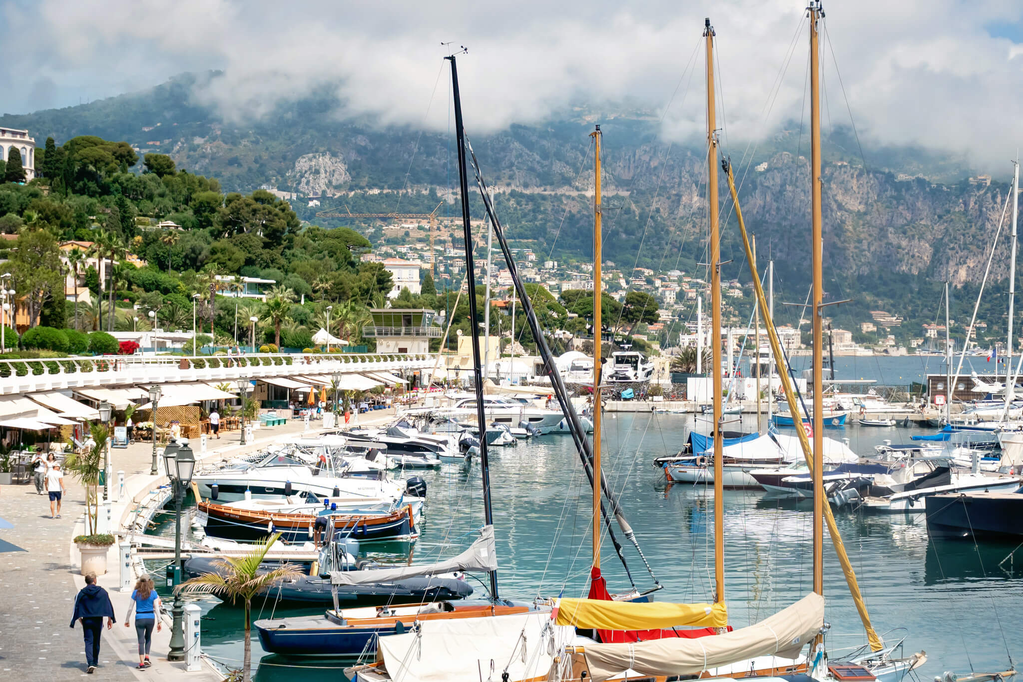
The coastal path that we walked starts near the charming town of Saint-Jean-Cap-Ferrat, so you’ll need to navigate there. If you’re staying in Villefranche-sur-Mer or Beaulieu-sur-Mer, which are towns on opposite sides of the Cap Ferrat peninsula, your best bet is to take an Uber or buy tickets for the public bus line.
From our two-bedroom rental in Villefranche-sur-Mer, it took a 15-minute Uber ride to Saint-Jean-Cap-Ferrat. I don’t recommend trying to walk, as it takes about an hour and is mostly along windy, somewhat busy roads. If you are coming from communities further away or you have a train pass, you can always take the train to Beaulieu-sur-Mer and catch an Uber from there.
Once in Saint-Jean-Cap-Ferrat (pictured below), be sure to have a trail app or other mapping app pulled up on your phone so you can easily find the trail. We used Google and Apple Maps, and they were pretty accurate. AllTrails also has the two major Cap Ferrat coastal paths in its system. The two maps in the following sections are courtesy of AllTrails. While we had great internet service with our AT&T International Day Pass, I always make sure to screenshot maps in advance, just in case!

The Two Coastal Paths On Cap Ferrat
As I just mentioned, there are two main Cap Ferrat coastal paths people take around the peninsula. Therefore, I want to make sure you know the difference and which one we are talking about today! You can also combine these into one longer hike!
Main Loop
The larger path is a loop that skirts the entire perimeter of the bottom half of the peninsula. It is 3.9 miles long and starts and ends at Saint-Jean-Cap-Ferrat. Most hikers take around 2 hours to complete it, and it has quite a bit of elevation change, too.
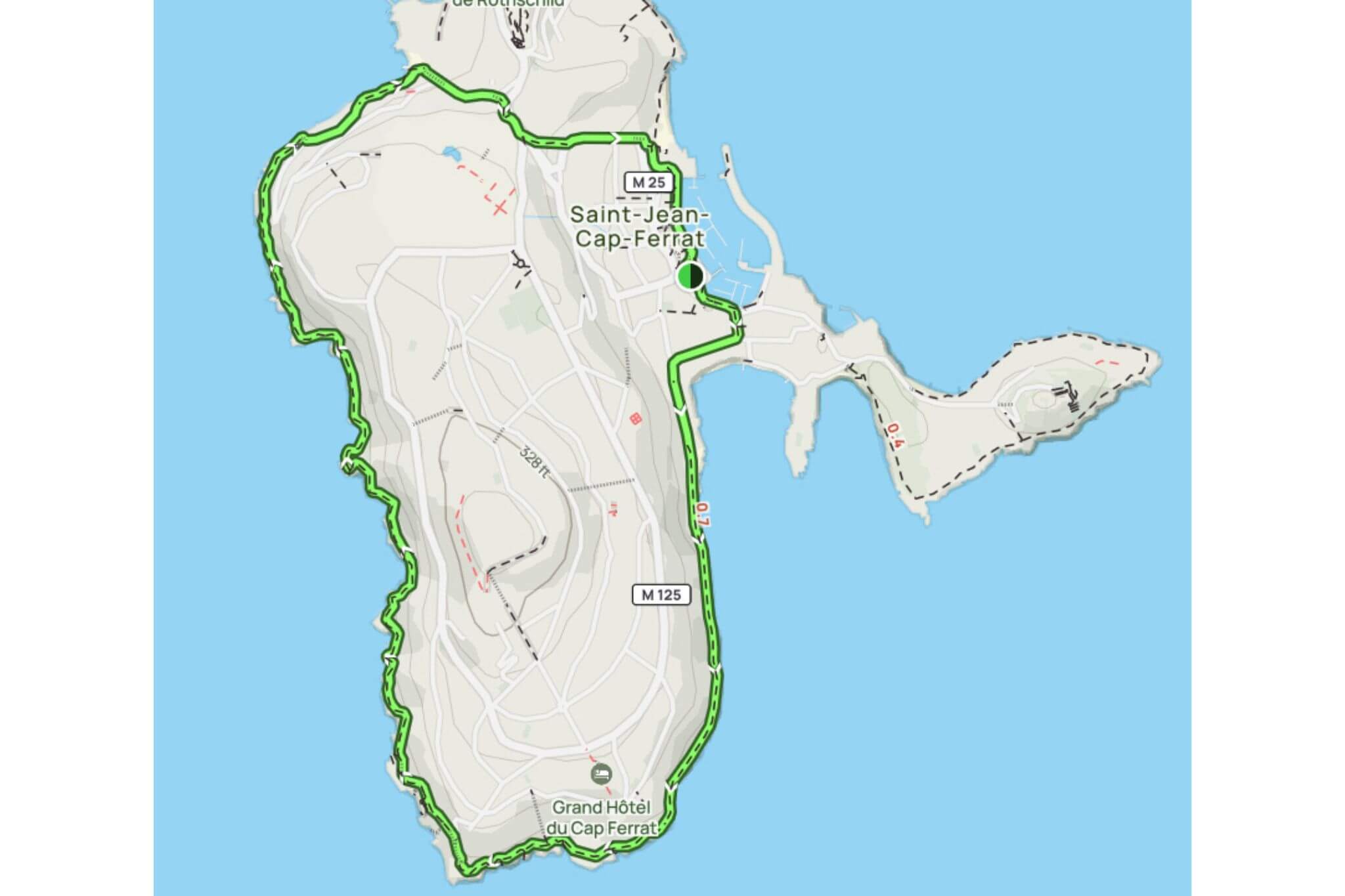
Eastern Loop
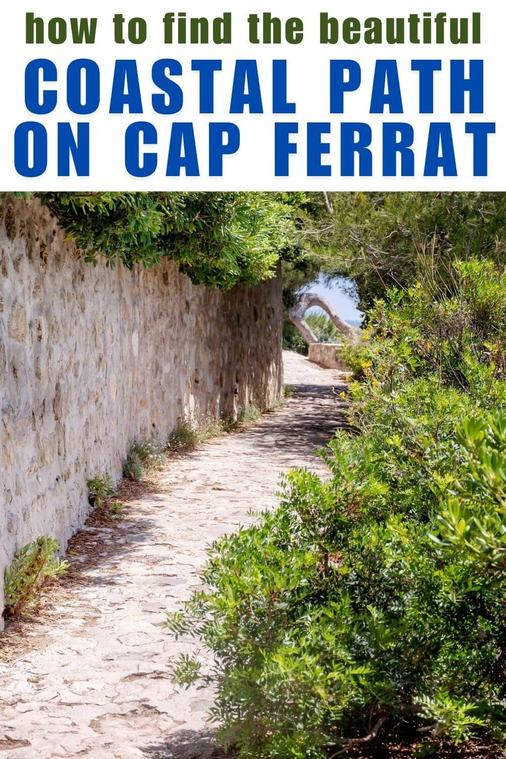
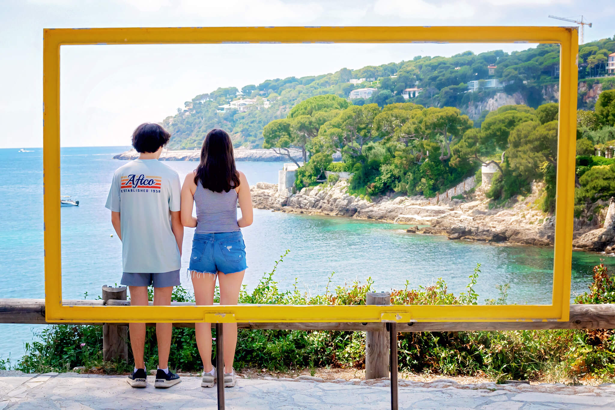
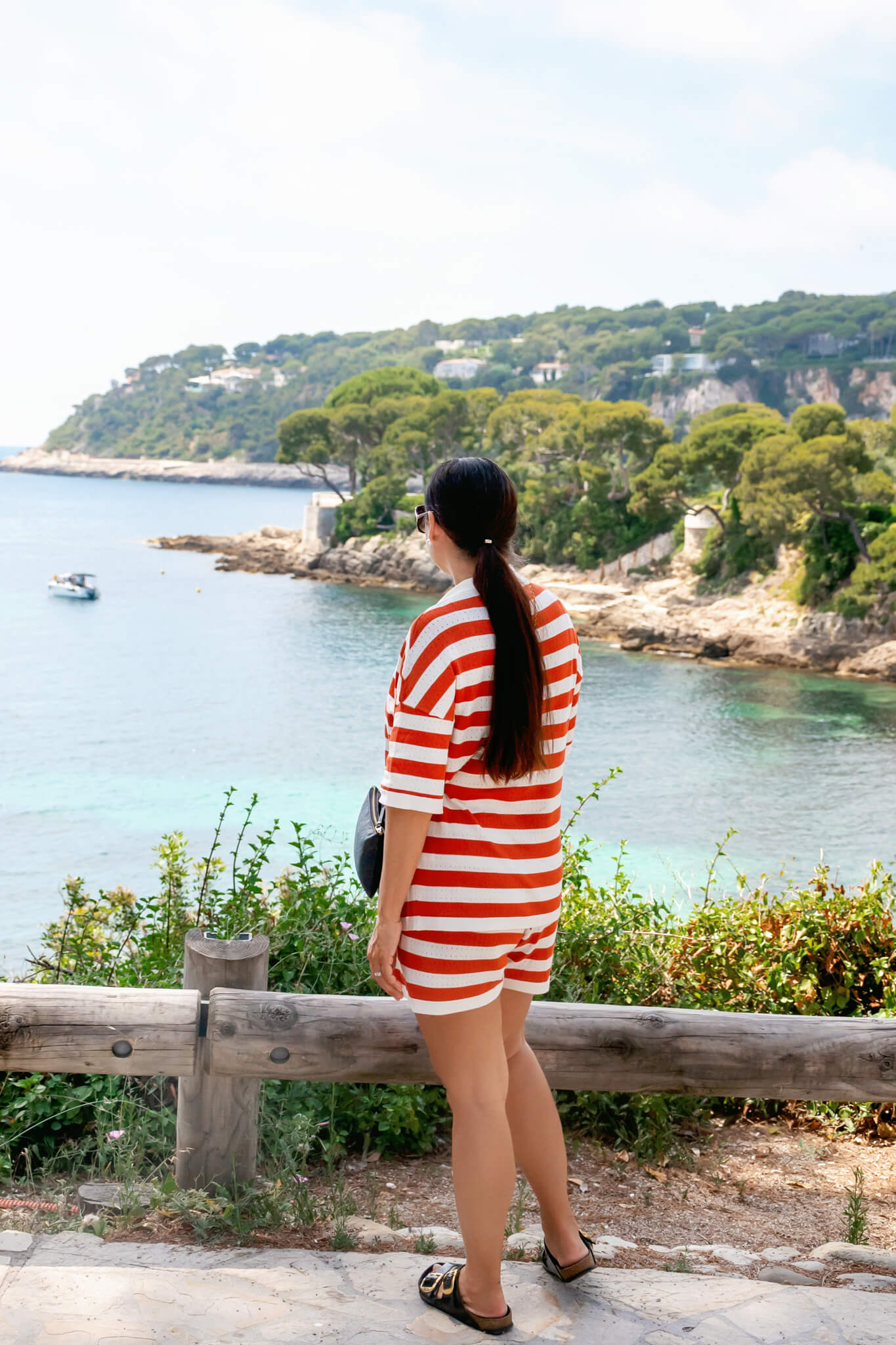
This is the loop we took. It starts and ends in Saint-Jean-Cap-Ferrat and extends around the eastern spur of the peninsula. The path we took was 2.8 miles and included our walk to the start of the coastal path from town. Once on the path. We took our time and savored the amazing views, and it took about an hour.
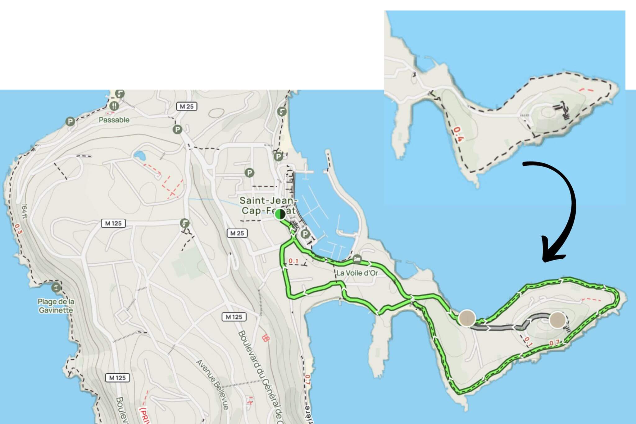
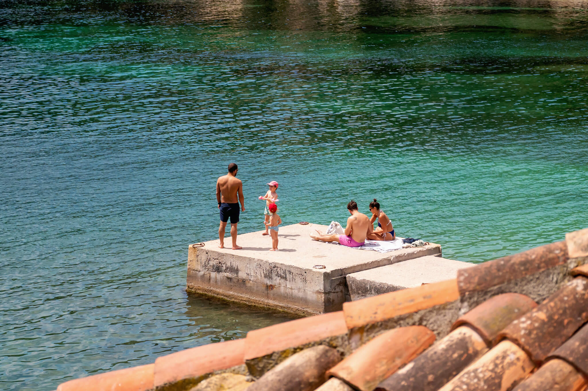
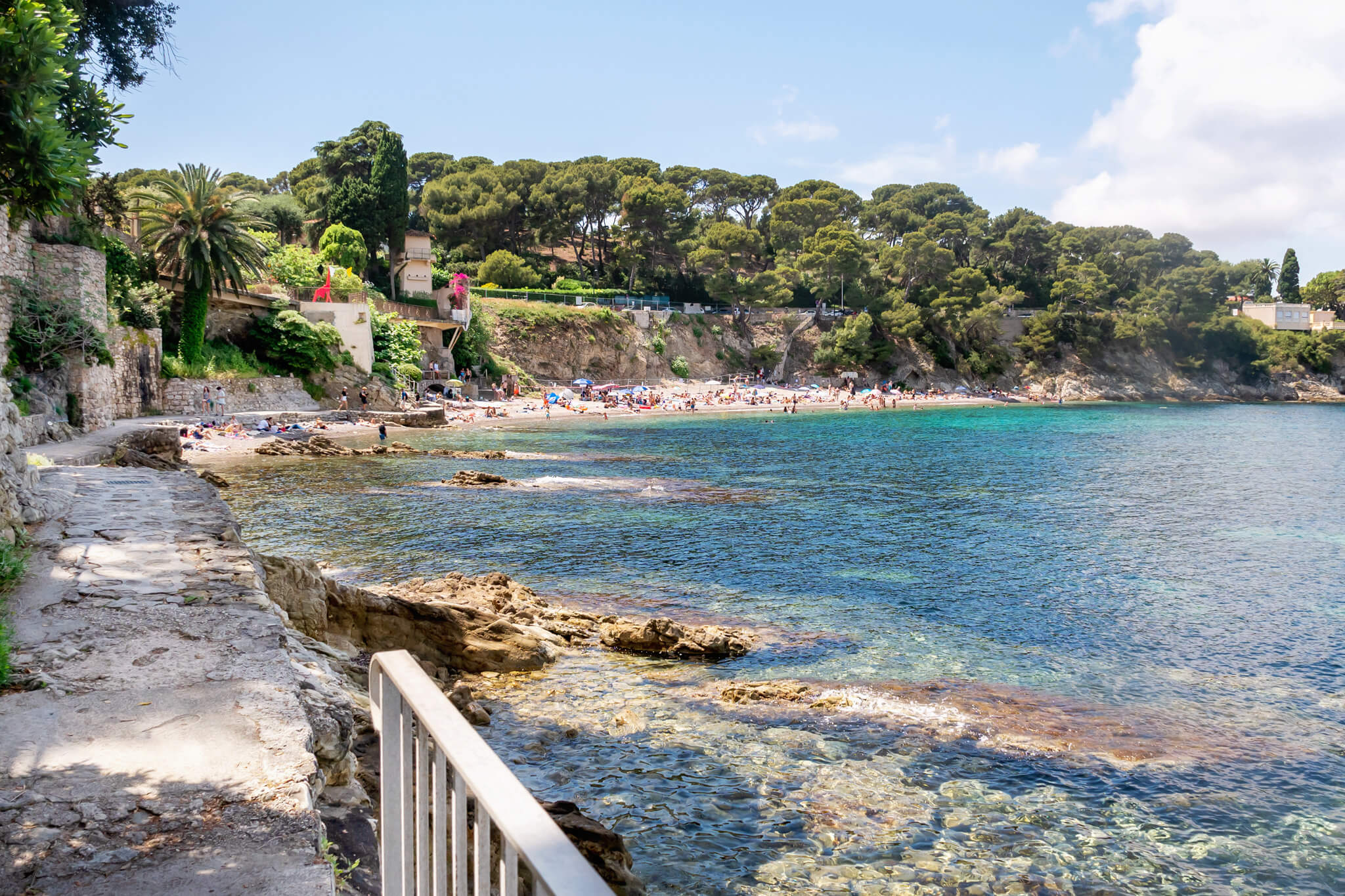
Above is another map that Matt made in AllTrails that shows the exact walk we took. As I mentioned above, part of this involved walking along the road from town. The dotted line portion is the actual coastal walking path. We took this specific route because I wanted to see all three of the main beaches in this area. And I am glad I did, because the first one, shown below, was stunning!
- Plage de la Fosse
- Plage de la Fossettes
- Plage Paloma
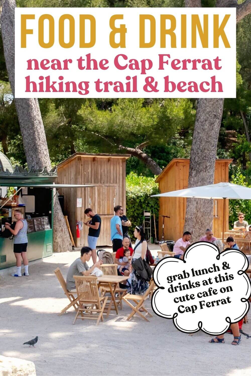
TIP: To find the eastern loop trailhead for the actual walking path (dotted section), look on Google Maps for the “Fontaine Coexist” marker. There is also a cute cafe right there, and it’s a great place to get dropped off if you want to skip stopping in Saint-Jean-Cap-Ferrat. But it’s all so close, and we enjoyed seeing a bit of the community along with the coastline.
Planning Your Cap Ferrat Itinerary
Walking on the Cap Ferrat coastal path is a great way to spend a morning. We ate breakfast early in Villefranche-sur-Mer and then took an Uber to Saint-Jean-Cap-Ferrat. After walking the coastal path, we ate lunch and then took some time to sunbathe at one of the beaches near the path. The entire outing took about four hours and was the perfect way to spend half a day enjoying the natural beauty of the area.
If this is your first time visiting the French Riviera, I want to point out that most beaches are rocky. I highly recommend packing a pair of water shoes. We also always travel with our favorite Dock and Bay towels. They fold up small in our suitcases and dry really fast!
Cap Ferrat Coastal Path: Our Experience
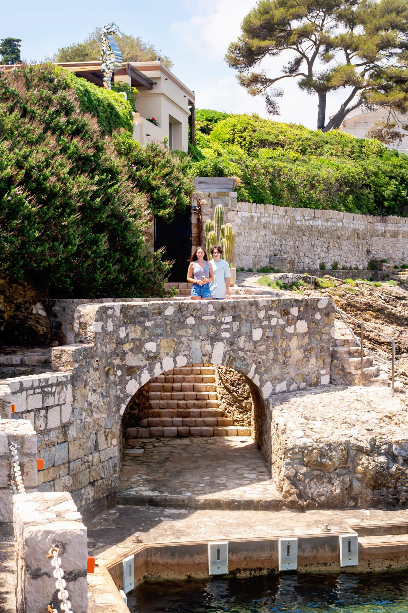
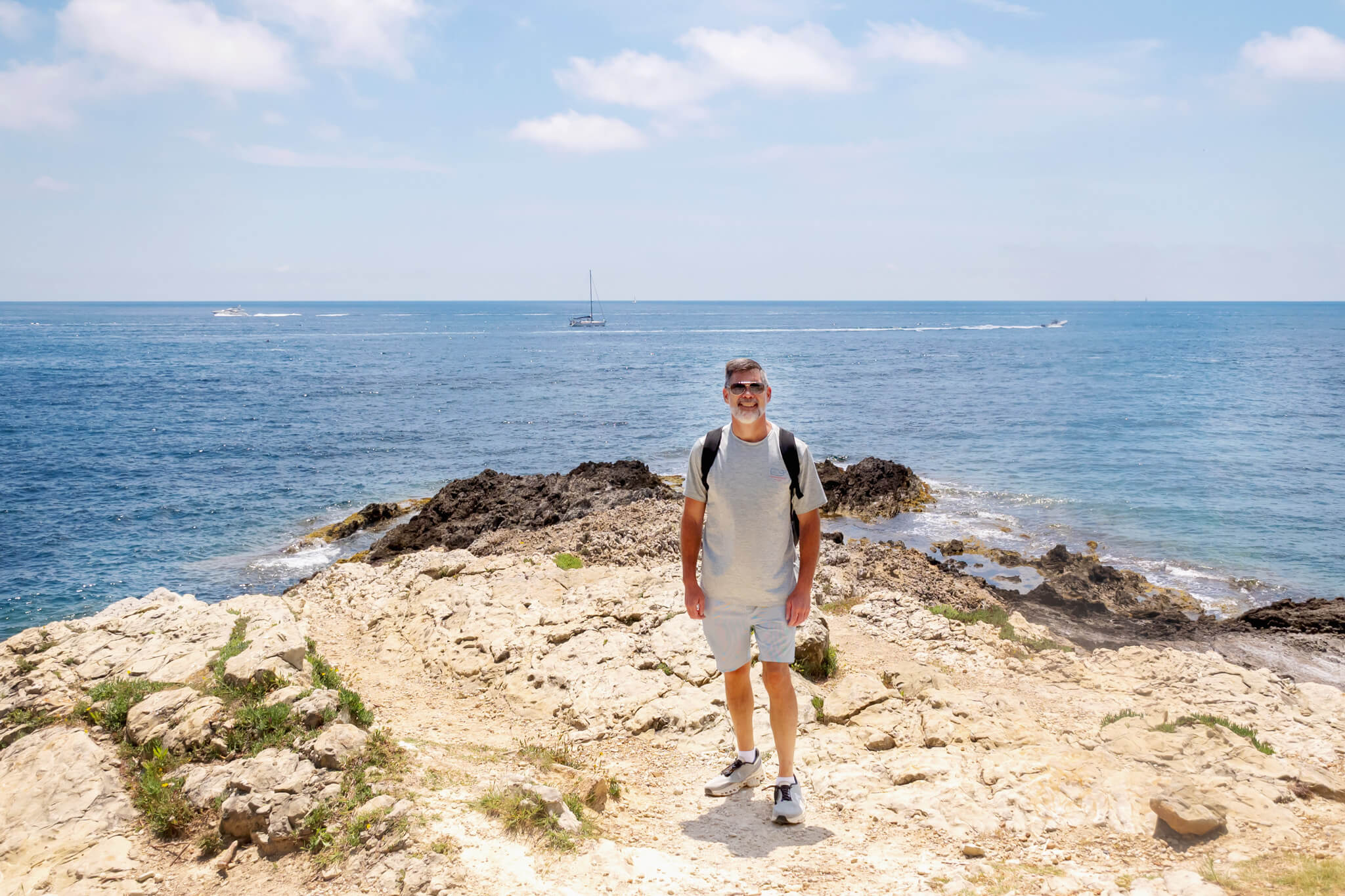
So, now I want to share more about our personal experience on the hike from start to finish. As a reminder, we did the eastern loop and started on the southern side of the loop near Plage des Fosse. Our whole family enjoyed it, and our two high schoolers walked way ahead of us. We don’t mind, though! It gives them some independence and a nice time spent together.
Starting Our Cap Ferrat Hike
Once we were in Saint-Jean-Cap-Ferrat, we walked about a half mile along city streets until we reached the place where the actual trail starts along the coast. The town is beautiful, with amazing homes and lavish gardens. We quickly understood why Cap Ferrat is one of the most expensive residential locations in the world!
Related Link: What Do In Saint-Jean-Cap-Ferrat
I have added Grand-Hotel du Cap-Ferrat, a Four Seasons Hotel, to my bucket list. I follow them on Instagram and drool over everything they post. It looks so incredible!
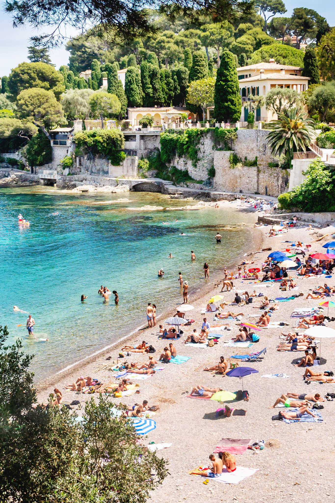
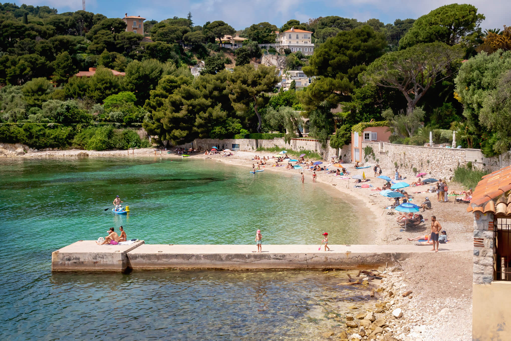
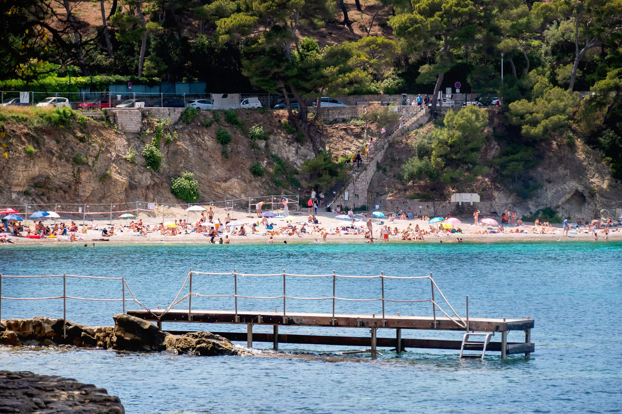
At the trailhead is a wonderful little open-air cafe, almost like a food truck. It’s called La Pointe du Cap Ferrat. It serves a wide variety of items like pizza and sandwiches, as well as pastries and drinks. They even had Rose! For the area, the prices were really affordable, and the food was great. There’s seating and a cute public water fountain here. There are also amazing views of a large public beach down the cliff, named Fossettes Beach (or “Plage des Fossettes” in French).
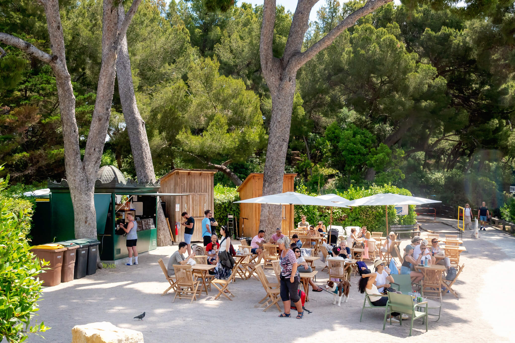
On some maps, part of this Cap Ferrat coastal path is labeled Promenade des Fossettes. This is basically the footpath section that starts at the small restaurant and ends at Paloma Beach. You could easily do this portion, and it would probably take about 30 minutes. You would just miss seeing Plage de la Fosse.
Hiking The Cap Ferrat Coastal Path
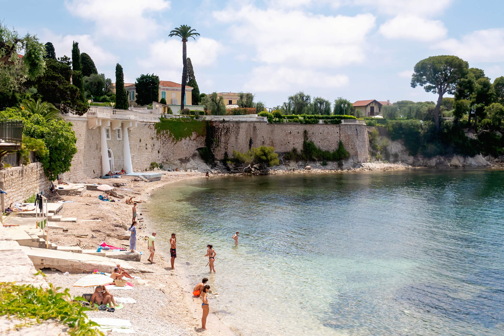
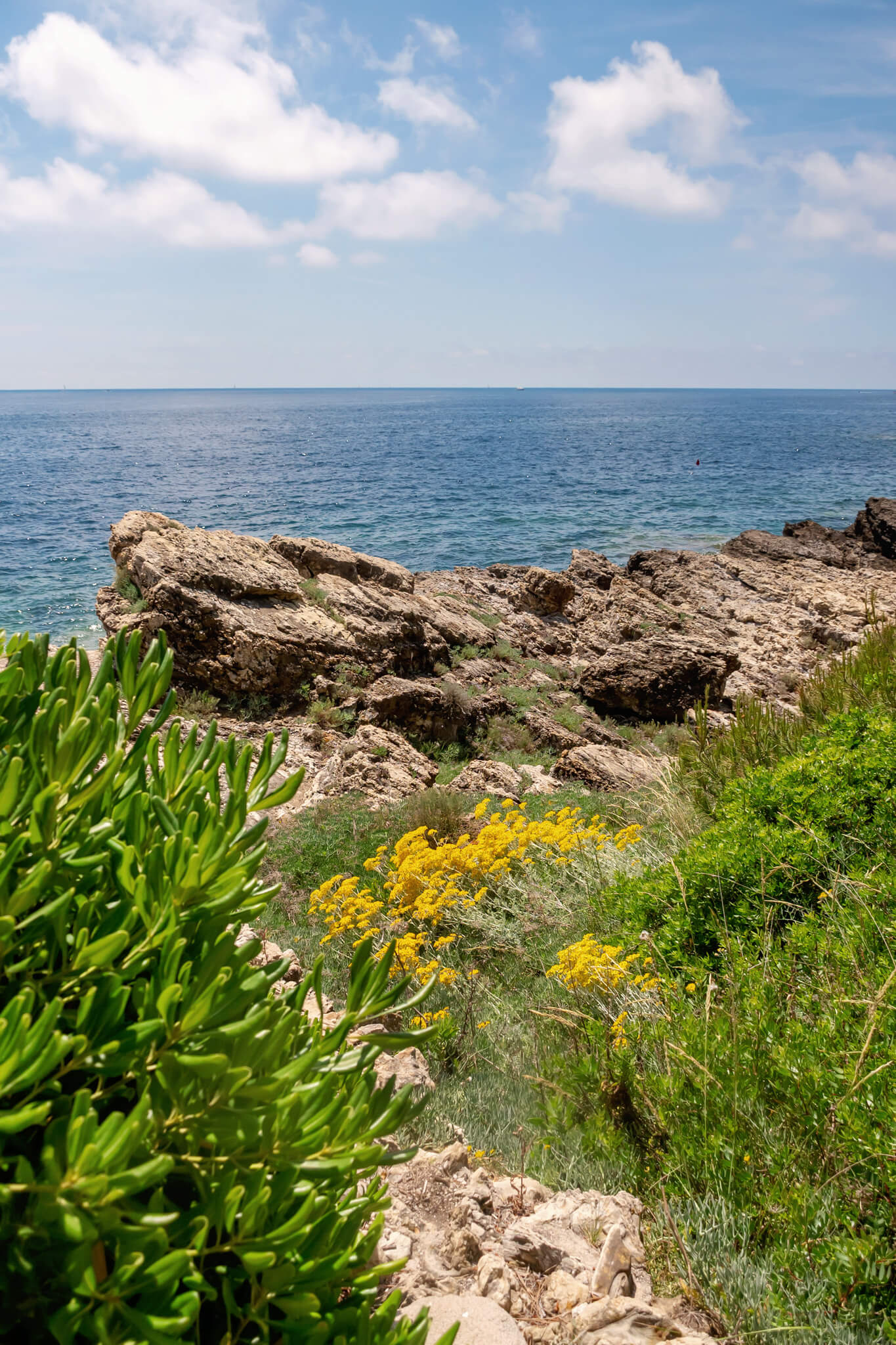
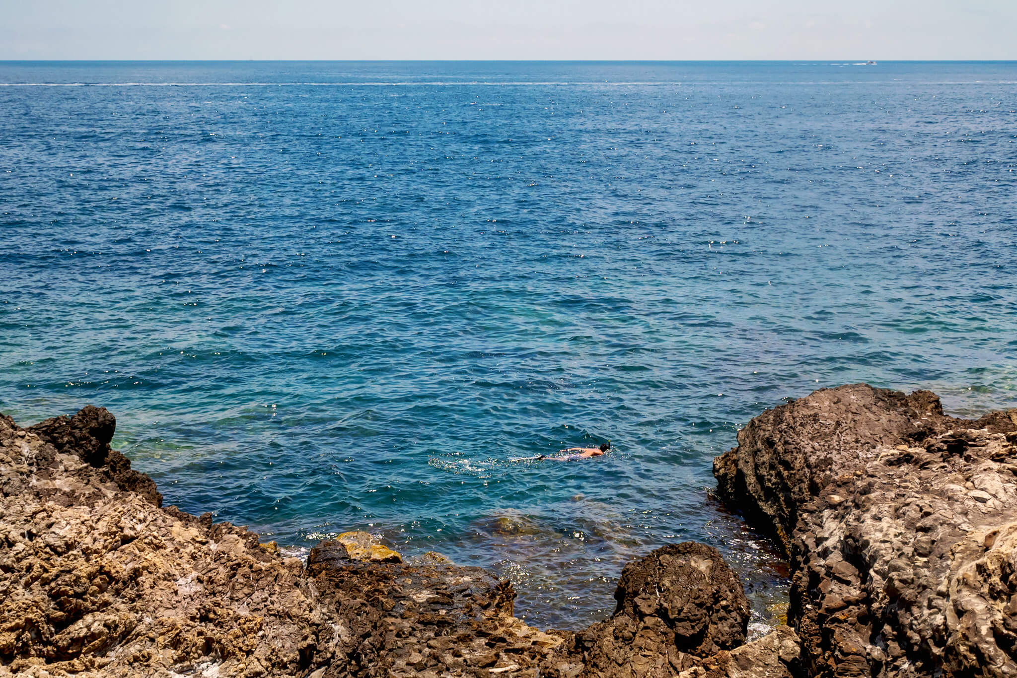
The hike around the coastal path offers almost continuous stunning views of the Mediterranean. Everywhere you look, you see picturesque deep blue waters contrasted against jagged limestone rocks.
I do use the term “hike” very loosely here. It really was a leisurely stroll on easy terrain. This was quite a contrast to our Cap d’Antibes hike from last year, where the path was very rocky and difficult to navigate in some places.
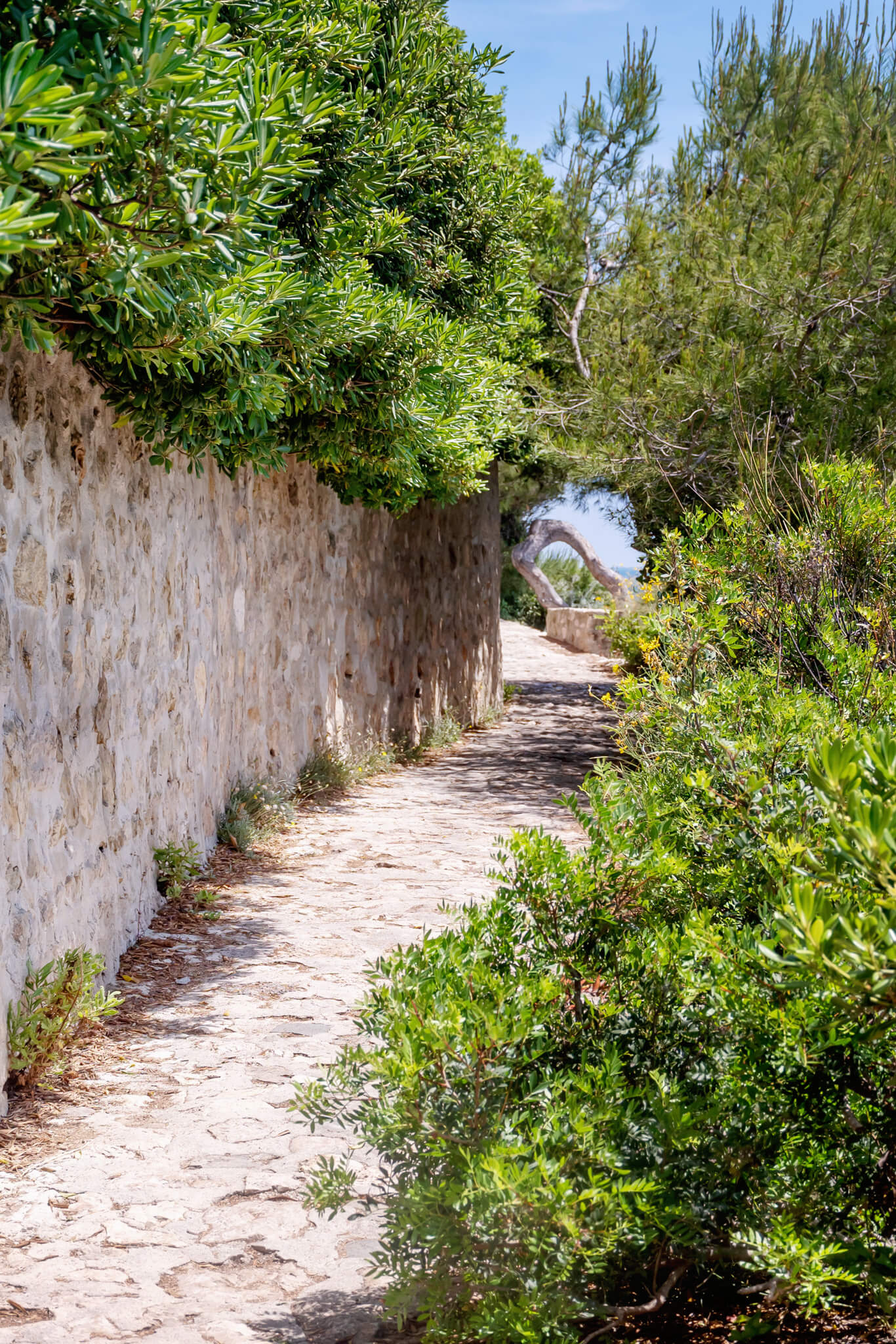
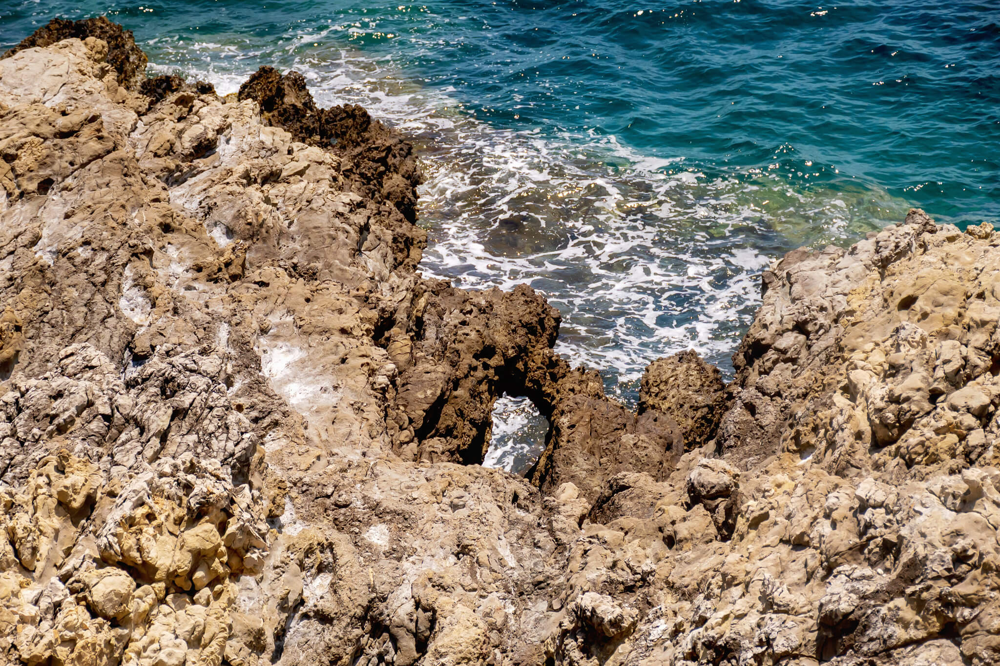
The trail winds along the perimeter of the coast, dipping down near the water in places or rising higher up along the cliffs. As we walked, water crashed against rugged rocks, and the sea swelled, sending mist into the air. We saw local flora like olive trees, Aleppo pines, succulents, and native plants like crithmum, silver ragwort, and sea lavender line the trail.
We walked beside mansions and private estates hidden from view by tall fences and vegetation. In the distance, yachts cut across churning waters. The warm summer sun felt great, and the air smelled of sea salt.
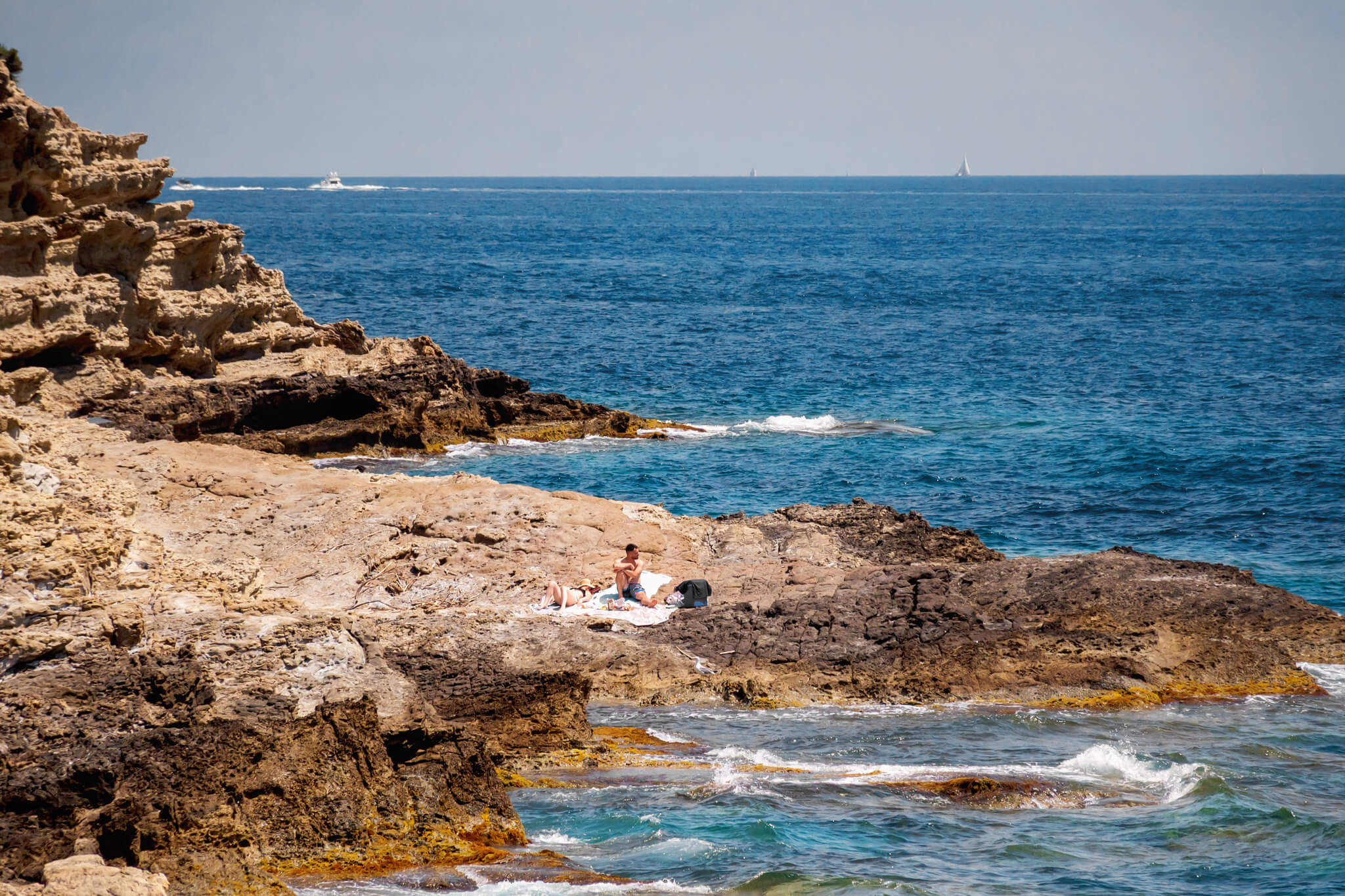
We didn’t encounter any areas that were particularly hard or dangerous to traverse. Most people without mobility issues should be able to participate in this. On our walk, we saw both couples and families enjoying the day, some sunbathing and others fishing in the azure waters. Several families had pets. Dogs are welcome on the trail but must be on a leash.
Ending Our Cap Ferrat Hike
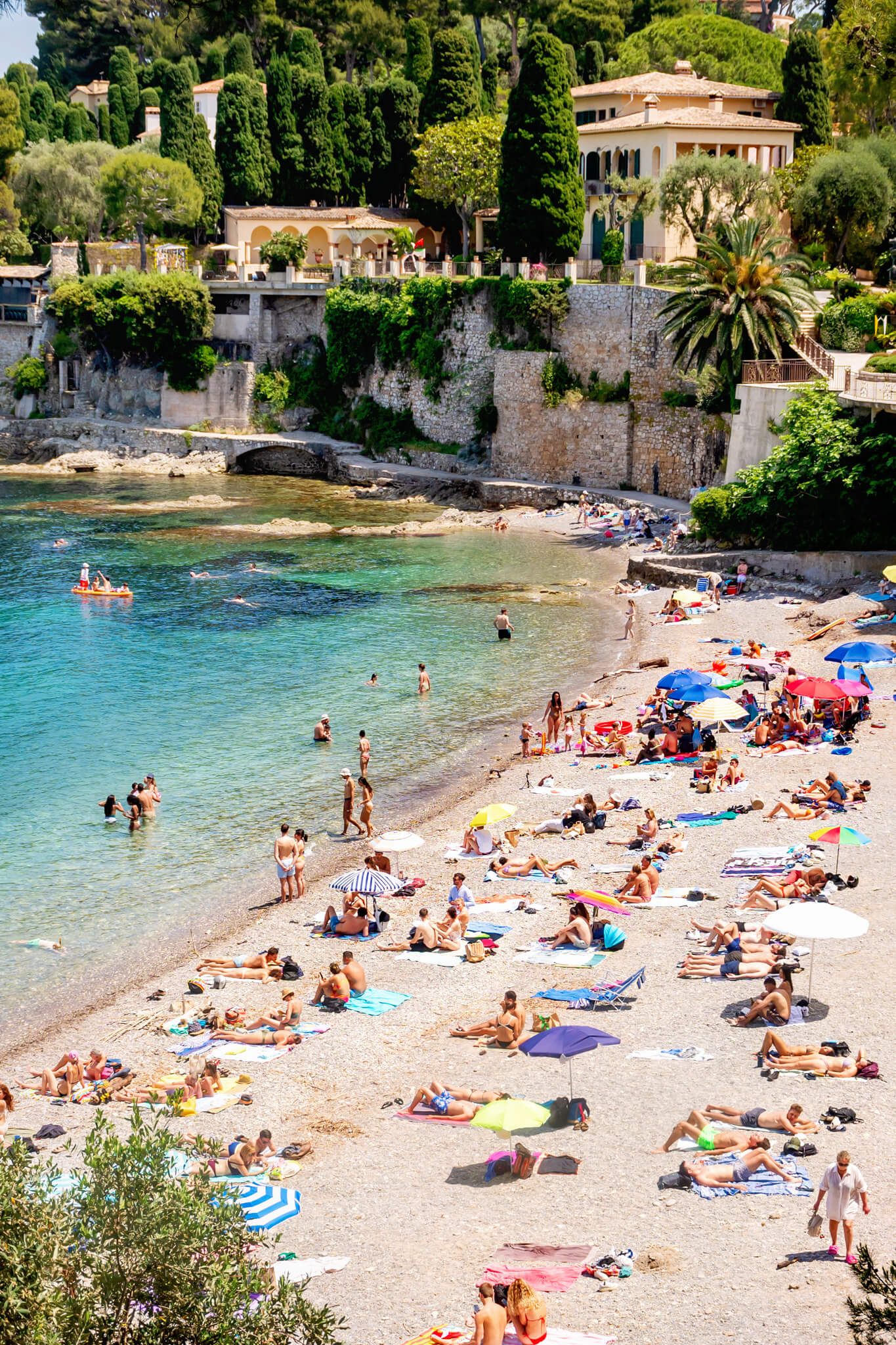
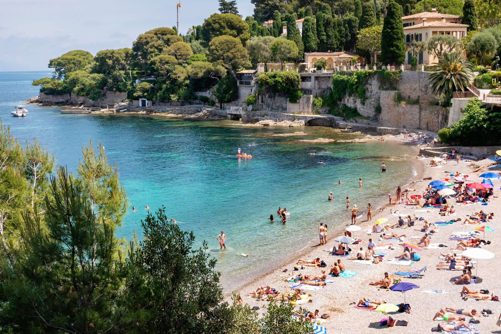
Near the end of the Cap Ferrat coastal path (going south to north) is an iconic beach called Paloma Beach (“Plage Paloma”). Paloma Beach is really stunning and was crowded with locals when we were there. It is set against a high bluff and surrounded by gorgeous Greek-style buildings. I am sure you have seen it in photos before, but here is one that I took!
After enjoying Paloma Beach, we walked to Saint Jean Cap Ferrat. We looked around town for a bit and then walked back to the little cafe at the trailhead, where we got lunch. We spent another hour or so sunbathing at Fossettes Beach while Matt and Jake watched some locals play bocce ball. I actually preferred Fossettes Beach over Paloma Beach. It was less crowded and felt a little bit less touristy.
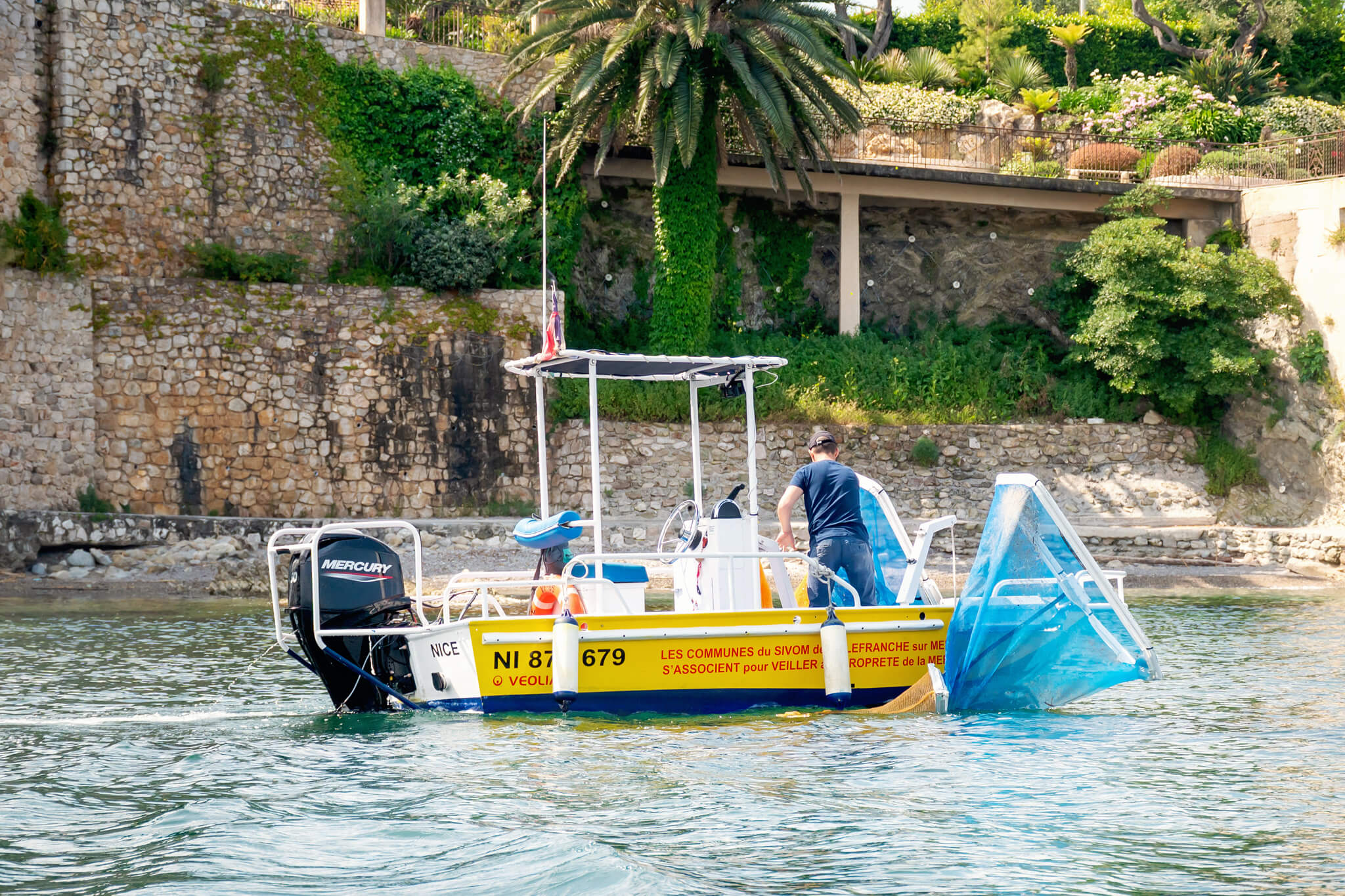
We also found this interesting, so you might, too! Along Cap Ferrat, they had a little street sweeper-like boat that collected what I assume is trash, sticks, and seaweed in its nets. When this came around, people got out of the water so that they could pass by. We saw this on two beaches that day!
Add The Cap Ferrat Coastal Path To Your Côte d’Azur Itinerary
We loved walking the Cap Ferrat coastal path. I recommend adding it to your France vacation itinerary. It makes a great half-day trip for those staying in towns on or close to the Cap Ferrat peninsula.
As I hope my pictures convey, the path is gorgeous. You’ll enjoy the natural beauty of the French coast while seeing magnificent estates and getting some exercise. And, for a sunny day in early June, I was shocked by how few people were enjoying this walking path. It was definitely a bucket list experience for my family!

More France Travel Inspiration
I assume that if you are reading this post, you have a trip to France planned! So, take a minute to browse all of my other France travel blog posts. In the past few years, I have visited Paris a half-dozen times and explored many charming towns along the French Riviera. I know that you will appreciate my tips for international travel as well!
Here are some of my blog posts about France:
- 4 Days in Paris
- Visiting Antibes, France
- Top Paris Landmarks
- Our Cassis Boat Tour
- Montmartre Food Tour in Paris
- Visiting The Louvre
- Taking A Seine River Cruise
- Family Tours in Paris
- Calonques National Park
- Cap d’Antibes Hike
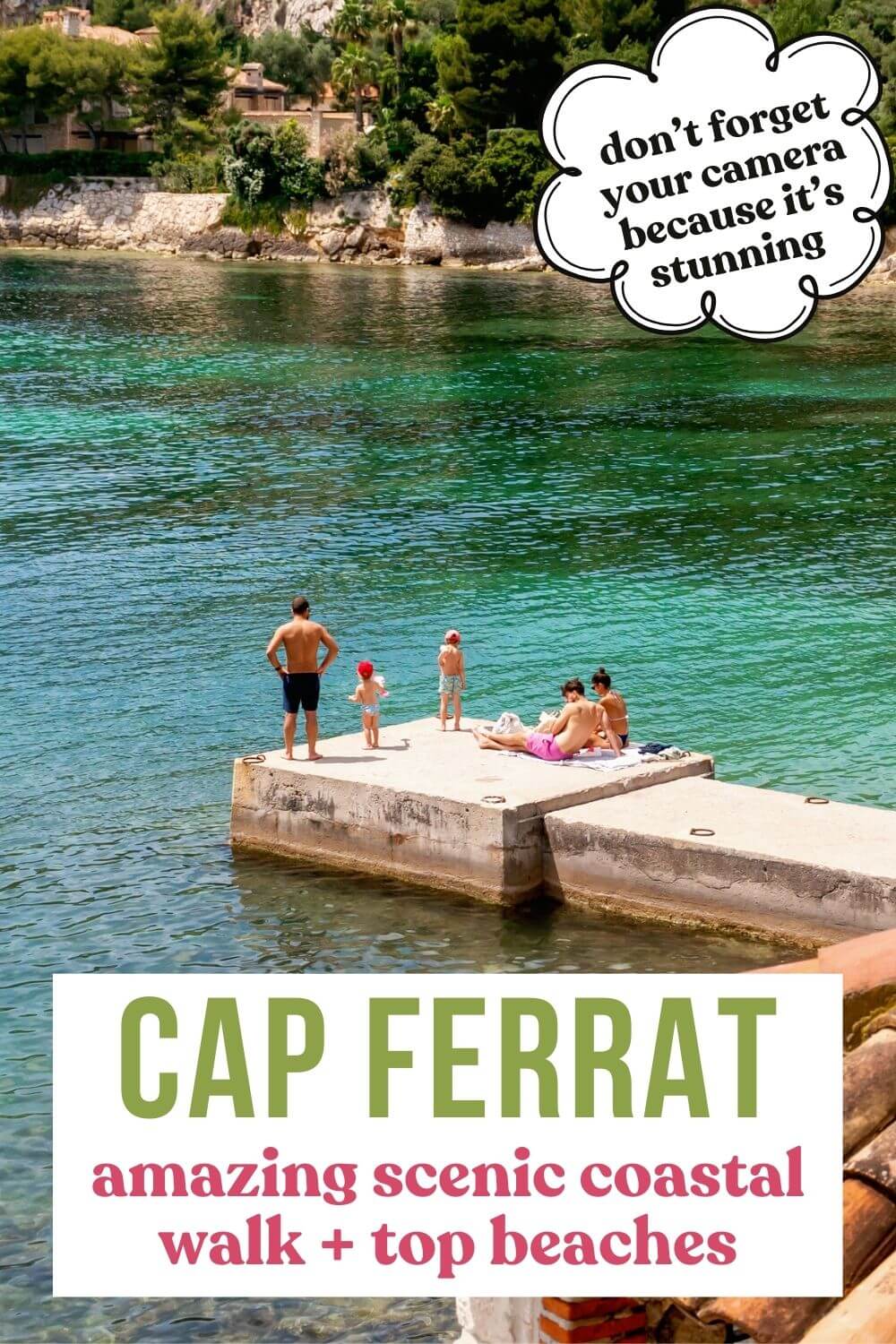
PIN: Cap Ferrat Coastal Path For Later